The official website of Visit Causeway Coast and Glens
En

Ballycastle Beach

Carrickmore Road, Ballycastle, County Antrim, BT54 6QS
aerial view of Ballycastle Beach
  • aerial view of Ballycastle Beach
  • Product Image
  • Product Image

Book Tickets Online

About

Update 7th February 2024: The footbridge at Pans Rock on Ballycastle Beach is currently closed due to structural damage caused during recent storms. This notice will be removed when the bridge reopens.


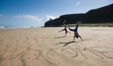
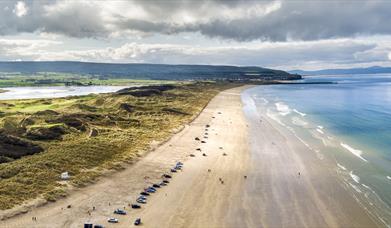
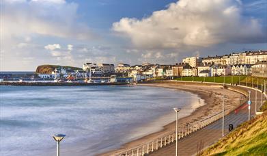
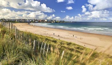
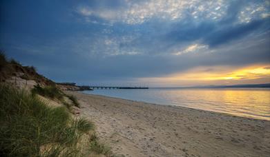
Ballycastle Beach is a popular tourist destination located on the Causeway Coast Route on the Antrim Coast of Northern Ireland. Ballycastle Beach is approximately 1.2 kilometres in length and runs from the pier at Ballycastle Marina at the western end to Pans Rock in the east. Ballycastle Beach is comprised of predominately sand with some shingle. It backs on to Ballycastle Golf Course for most of its length. There is a promenade at the western end. The beach is located near the Marina, less than 1 mile from town centre

There are no restrictions on swimming at this beach and a seasonal lifeguard service is provided by RNLI Beach Lifeguards (July-August 11am-7pm).

Facilities: Car parking, Child friendly areas, Visitor Information Centre nearby, Seasonal RNLI Beach Lifeguards Service (July & August 11am - 7pm daily), Dogs are permitted (restrictions apply 1st June - 15th Sept), wheelchair access, disabled toilets and disabled parking

The eastern end of Ballycastle Beach is part of Ballycastle Coalfield ASSI. Ballycastle Coalfield is the best exposure of a coalfield sequence in Ireland. It contains a series of Carboniferous sedimentary rocks (335-330 million years old) with contemporary lavas and younger Tertiary igneous rocks (60 M.y.). The sedimentary rocks were deposited in a shallow marine bay which gradually developed into a vegetated coastal swamp subject to periodic flooding by the sea. The vegetation was preserved as seams of coal. Fossils that have been found include goniatites (shellfish), fish remains, giant clubmosses and arthropod insects. The Tertiary dykes have metamorphosed the carboniferous shales to produce porcellanite and a range of minerals. The site also contains evidence of early industrial activity: the coals and iron ores were mined between the 16th and 19th centuries.The underlying geology and the spoil heaps give rise to both base rich and acidic habitats, including wet grassland, base-rich flushes and maritime heath. Limited saltmarsh occurs on some of the beaches.

Facilities

Establishment Features

  • Toilets

Parking & Transport

  • On site parking

TripAdvisor Traveller Rating

TripAdvisor Traveller Rating - 346 reviews346 reviews

Add Ballycastle Beach to your Itinerary

Close window

Call direct on:

Tel+44 (0) 28 2076 2024

Map & Directions

What's Nearby

  1. Remains of Franciscan friary founded around 1500 by Rory MacQuillan. East range of…

    0.55 miles away
  2. Folk and social history of the Glens in the town's 18th century courthouse. Exhibits…

    1.39 miles away
  3. We specialise in producing smoked foods naturally, in the picturesque coastal town of…

    1.73 miles away
  1. Kinbane Castle is a Historic Monument sited in the townland of Cregganboy, located along…

    3.21 miles away
  2. A traditional Irish sheep farm experience in County Antrim. Get an insight into sheepdog…

    4.25 miles away
  3. Nestled within the famous Glens of Antrim you can expect a warm welcome at Dunfin, a…

    4.25 miles away
  4. This vantage point looks out over several islands, namely Rathlin, Carrick-a-rede and…

    4.65 miles away
  5. Five-mile drive through peatland forest with many fine views of Rathlin Island and…

    4.66 miles away
  6. Carrick-a-Rede one of Northern Ireland’s most loved attractions in Northern Ireland,…

    4.97 miles away
  7. A lonely and mysterious Moorland Lake, sometimes called the 'Vanishing Lake'.

    5.6 miles away
  8. Breakwater Studio on Rathlin Island is the Studio and Home of Yvonne Braithwaite. She is…

    6.01 miles away
  9. Amidst the rugged landscape of this isolated island, you can let your mind wander and…

    6.06 miles away
  10. Rathlin is Northern Ireland’s only inhabited off-shore island and is thought to come from…

    6.34 miles away
  11. Ballintoy Harbour can be discovered in the picturesque village of Ballintoy. Known as a…

    6.41 miles away
  12. Just six miles off County Antrim's north coast with must see views of Northern Ireland's…

    6.85 miles away
  13. The Causeway Coast Discovery Centre is a 2014 and 2015 Tourism Award-winning centre. A…

    7.18 miles away
Previous Next

Map & Directions

Road Directions

Ballycastle Beach is located along the Causeway Coastal Route South from Bushmills, along the A26 and A44 from Ballymena and along the Causeway Coastal Route North A2 from Larne.

Public Transport Directions

The bus station is on Station Road, just east of the Diamond. Ulster Bus Express 217 links Ballymena with Ballycastle and the Goldline Express 218 links Ballymena with Belfast. Bus 172 goes along the Coast Road from Coleraine to Ballycastle via Bushmills, the Giant's Causeway and Ballintoy.  All buses depart from opposite The Marine Hotel on North Street.

View Maps and Visitor Guides
View of what Causeway Coast and Glens has to offer and some of the best things to see and do during a visit.
E-newsletter sign up
Sign up for the Causeway Coastal Route newsletter for inspiration and travel tips.
Back to Top

Tourism Northern Ireland

Don't Miss