The official website of Visit Causeway Coast and Glens
En

Kilrea to Movanagher Wood

The Diamond, Kilrea, Derry/Londonderry, BT51 5QD
forest service signage at Movanagher Wood
  • forest service signage at Movanagher Wood
  • gated pathway at Movanagher Wood
  • trail section at Movanagher Wood
  • trail section at Movanagher Wood
  • Road from Kilrea to Movanagher Wood

Book Tickets Online

About

This walk starts from the Diamond area in the centre of Kilrea, a rural market town which was developed during the Plantation of Ulster.  

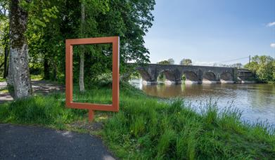
Leaving the Diamond, proceed along the footpath on Coleraine Street and Agivey Road for approx. 0.8 miles until reaching the junction with Movanagher Road.  Turn right into Movanagher Road (please note there is no footpath on this road, so exercise caution and follow Highway Code rules) and follow this quiet country road for approx. 0.8 miles until reaching a laneway on the right giving access into Movanagher Wood.  There is a variety of trails within the forest (none of which is waymarked) stretching along the western bank of the River Bann.  Having enjoyed the tranquility of this riverside setting, retrace your steps to the starting point in the Diamond.

Facilities

Establishment Features

  • Toilets

Parking & Transport

  • Car parking
  • Parking (free)

Map & Directions

What's Nearby

  1. A beautiful and historically important bridge within tranquil woodland, just outside the…

    0.78 miles away
  2. Covering 200 hectares, Garvagh forest is situated on the Western outskirts of Garvagh,…

    5.63 miles away
  3. Nestling on the edge of Garvagh forest, Garvagh Museum is one of the region’s best kept…

    5.65 miles away
  1. A 200-hectare forest containing many species of trees, wildlife – and even a pyramid…

    5.66 miles away
  2. Rosepark Farm is a family run attraction spread over 70 acres, situated in the North…

    6.13 miles away
  3. A Neolithic court tomb dating from c.4000-2000BC. It is named after the Dooey family who…

    6.81 miles away
  4. A megalithic tomb, dating to the Neolitic or New Stone Age (2000-4000) is found in…

    7.25 miles away
  5. Travel 3 miles west of Garvagh town and you will begin to enter Gortnamoyagh Forest,…

    7.6 miles away
  6. In this beautiful setting visitors have time to reflect on the unprecedented achievements…

    8.17 miles away
  7. The Blackheath Pottery is a unique pottery and café, situated between Coleraine and…

    8.32 miles away
  8. A pleasant urban 40-acre Park in the heart of Ballymoney Town, in which to enjoy a…

    8.35 miles away
  9. From the Mesolithic to Motorcycles, through rebellion and war, politics, industry, sport…

    8.41 miles away
  10. A striking local landmark, the church tower is the oldest structure in Ballymoney. An…

    8.42 miles away
  11. This burial ground is the site of the ruins of the old parish church which was completed…

    8.42 miles away
  12. Ballymoney’s Arts, Museum and Visitor Information Centre is well worth a visit. This…

    8.43 miles away
  13. A picturesque wooded picnic area on the banks of the Lower River Bann – with an important…

    10.08 miles away
Previous Next

Related

Frame at Portneal, KilreaPicture This: Portneal, Kilrea, KilreaA beautiful and historically important bridge within tranquil woodland, just outside the pisturesque village of Kilrea.

PORTNA LOCKPortna/Hutchinson's Quay Riverside Walk, Northern IrelandA pleasant 4 mile return linear riverside walk, along the western bank of the River Bann, connecting Portna locks and Hutchinson’s Quay.

Craig's Dolem - a Stonage Age grave Craig's Wood, Northern IrelandCraigs Wood is a small wood located on the Long Mountain, accessed from Mullan Road, approx. 2 miles north east of Rasharkin.

Map & Directions

View Maps and Visitor Guides
View of what Causeway Coast and Glens has to offer and some of the best things to see and do during a visit.
E-newsletter sign up
Sign up for the Causeway Coastal Route newsletter for inspiration and travel tips.
Back to Top

Tourism Northern Ireland

Don't Miss