Book Tickets Online
About
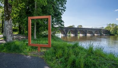
This is a pleasant 4 mile return linear riverside walk, which is approximately 1.2 miles south east of Kilrea town, along the western bank of the River Bann, connecting Portna locks and Hutchinson’s Quay.
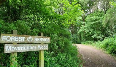
The starting point for this walk is the small car park at the end of Portna Road, adjacent to the small slipway. Proceed along the canal-side pathway upstream, keeping the canal and river on your left, until reaching Hutchinson’s Quay. At this point walkers can retrace their steps to the starting point, or choose to walk a further section of riverside path through Moneygran Wood, eventually ending in a dead-end, at which point walkers retrace their steps to the starting point. At the starting point walkers can cross over a small bridge onto an ‘island’ and explore the sluice gates and other structures in the river used for catching eels, retracing their steps to the car park.
Facilities
Accessibility
- Designated parking provided for guests with disabilities
Catering
- Picnic Area
Leisure Facilities
- Fishing
Parking & Transport
- Car parking
- Parking (free)
- Parking Areas for Disabled Visitors