The official website of Visit Causeway Coast and Glens
En

Slieveanorra Summit Walk

Altarichard viewpoint, Altarichard Road, Armoy, Ballymoney, Antrim, BT53 8XT
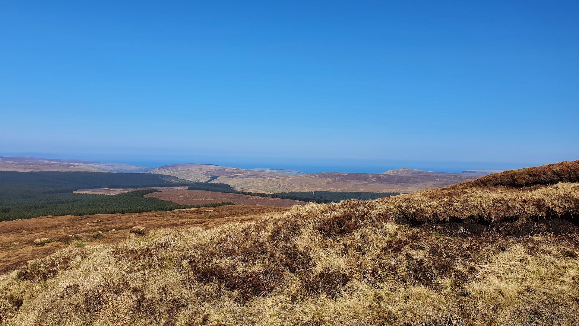
view from Slieveanorra
  • view from Slieveanorra
  • view from Slieveanorra
  • signage at Slieveanorra

Book Tickets Online

About

The starting point for the 2 km trail (4 km return) to the 508m summit of Slieveanorra is the entrance to a forest road on the southern boundary of the Altarichard Road, signed for the Moyle Way and the Ulster Way/IAT.  Informal parking for 4 or 5 cars is available at this point.

The track climbs steadily through the trees for almost 1km, then exits the forest and you find yourself suddenly deposited on a high, open mountainside. As you climb, spare a thought for the doomed members of the McQuillan and O’Neill clans, who perished near here during the Battle of Orra in 1559.

The track becomes steeper and twists through several switchbacks on the final ascent towards the summit.  Walkers pass a small monument commemorating a tragic event during WWII.  In October 1942, a US Air Force B17 Flying Fortress bomber, making a trans-Atlantic flight bound for Prestwick, crashed into the mountain during poor visibility killing 8 of the 10 personnel on board.

On reaching the summit, in suitable weather conditions walkers are rewarded with fantastic panoramic views.  Knocklayd, Rathlin Island and the outline of Scotland are visible to the north and north-east, while Donegal and the Sperrins appear on the horizon to the west.  The volcanic plug of Slemish provides interest to the south, with Lough Neagh glimmering when the sun shines.

At this point walkers can turn and retrace their steps to the starting point, or for those seeking a further challenge, the forest road continues over the summit and descends through further forest cover in the direction of Altnahinch Dam.  Walkers should note this optional route is not waymarked.  Further off-road walking options are available by following the waymarked UW/IAT from the summit in a south easterly direction.

Did You Know? The north-eastern slope of Slieveanorra once played a prominent role in local history. During the Battle of Orra in 1559, the MacDonnell clan covered the ground with rushes to make it appear solid. Members of the rival McQuillan and O’Neill clans were tricked and floundered into chest-deep bog, only to be slaughtered as they tried to struggle free.  

Facilities:  Informal lay-by car parking for 4 or 5 cars.

Closest services/amenities in Armoy, Loughgiel or Cushendall

Facilities

Parking & Transport

  • Car parking
  • Parking (free)

Map & Directions

What's Nearby

  1. Located within the Slieveanorra and Croaghan Area of Special Scientific Interest (ASSI),…

    1.67 miles away
  2. Breen Oakwood is part of the larger Breen Forest and is one of the last fragments of the…

    2.9 miles away
  3. There are two way-marked hill walks at Altarichard on the scenic route between…

    3.39 miles away
  1. A traditional Irish sheep farm experience in County Antrim. Get an insight into sheepdog…

    4.28 miles away
  2. Nestled within the famous Glens of Antrim you can expect a warm welcome at Dunfin, a…

    4.28 miles away
  3. The Mc Donnell Trail Centre will help you understand some of the history of the castles,…

    4.56 miles away
  4. The Causeway Coast Discovery Centre is a 2014 and 2015 Tourism Award-winning centre. A…

    4.56 miles away
  5. This breathtaking venue combines the opulence of 1400 acres of private grounds and lakes…

    5.28 miles away
  6. Glenariff, the Queen of the Glens, is one of the nine Antrim Glens in Northern Ireland.…

    5.6 miles away
  7. A 13th century hilltop castle with a couple of names, a commanding view – and a…

    6.18 miles away
  8. Located one mile from Cushendall are the delightful ruins of a 13th century Franciscan…

    6.32 miles away
  9. A lonely and mysterious Moorland Lake, sometimes called the 'Vanishing Lake'.

    6.45 miles away
  10. Five-mile drive through peatland forest with many fine views of Rathlin Island and…

    6.52 miles away
  11. The beautifully restored Old Church Centre offers arts & heritage events, exhibitions,…

    7.16 miles away
  12. This beautiful avenue of beech trees was planted by the Stuart family in the eighteenth…

    7.63 miles away
  13. The ruins of Ardclinis Church and Graveyard occupy a beautiful setting overlooking Red…

    8.09 miles away
Previous Next

Map & Directions

View Maps and Visitor Guides
View of what Causeway Coast and Glens has to offer and some of the best things to see and do during a visit.
E-newsletter sign up
Sign up for the Causeway Coastal Route newsletter for inspiration and travel tips.
Back to Top

Tourism Northern Ireland

Don't Miss