Book Tickets Online
About
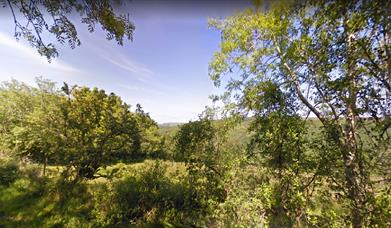
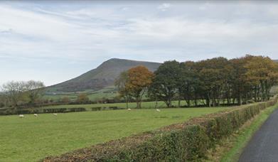
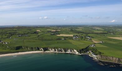
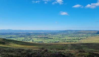
The International Appalachian Trail (IAT) Ulster-Ireland is one of a growing number of established IAT walking trails stretching across 3 continents which share a common geological heritage - the Appalachian-Caledonian Mountains. The 279 mile long-distance walking trail begins on West Donegal’s Atlantic Coast at the spectacular Slieve League cliffs, and journeys inland through the Blue Stack Mountains into County Tyrone in Northern Ireland. At this point the route picks up the Ulster Way, exploring the stunning Sperrins region and passing along the famous Causeway Coast including the Giant’s Causeway, before traversing the Glens of Antrim to reach its final destination at the port of Larne.
The 94 mile section of the trail within the Causeway Coast and Glens...Read More
About
The International Appalachian Trail (IAT) Ulster-Ireland is one of a growing number of established IAT walking trails stretching across 3 continents which share a common geological heritage - the Appalachian-Caledonian Mountains. The 279 mile long-distance walking trail begins on West Donegal’s Atlantic Coast at the spectacular Slieve League cliffs, and journeys inland through the Blue Stack Mountains into County Tyrone in Northern Ireland. At this point the route picks up the Ulster Way, exploring the stunning Sperrins region and passing along the famous Causeway Coast including the Giant’s Causeway, before traversing the Glens of Antrim to reach its final destination at the port of Larne.
The 94 mile section of the trail within the Causeway Coast and Glens region connects Dungiven and Waterfoot, following the route of the North Sperrins Way, the Causeway Coast Way and the Moyle Way. The route is clearly waymarked throughout and can be walked in either direction.
For more information on this route, please visit the official website here
Read Less